Political Delivery Mapping Made Easy.
CanvasserPRO gives political teams the tools to draw campaign areas, count deliverable properties, generate walk routes, manage field operations and turn geographic insight into structured action.
Built around the work your team actually does
CanvasserPRO is built for geographic planning, route management and disciplined ground execution.
A professional campaigning platform, not just a simple canvassing form
Every feature is designed to support practical campaign operations, from area planning to route generation and deployment in the field.
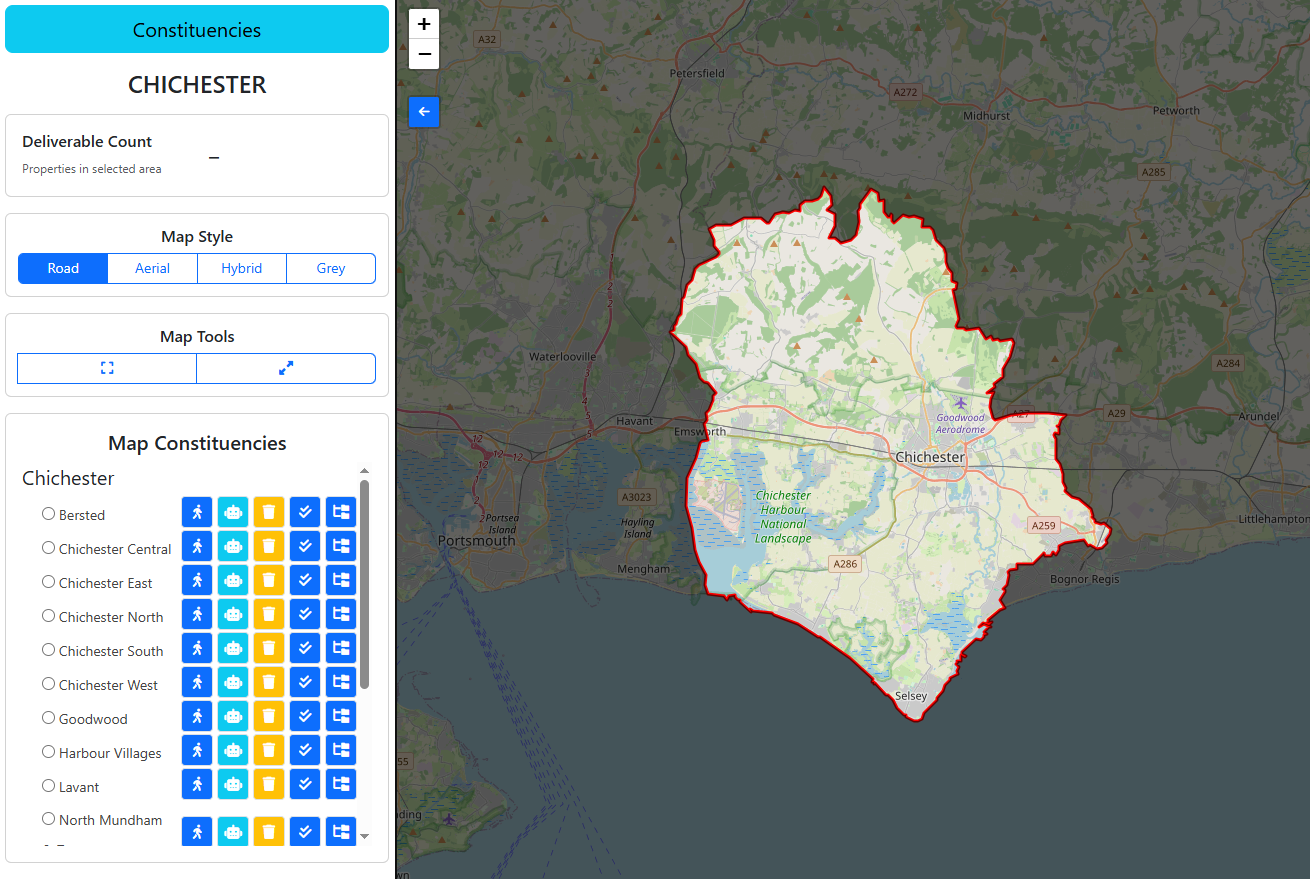
Area drawing tools
Create custom campaign zones or radius-based areas directly on the map. Shape your operation around the streets and neighbourhoods that matter.
Live property counts
See real-time deliverable property totals for any selected area, helping teams plan workload, coverage and walk route size with confidence.
Boundary-aware planning
Work within constituency and ward boundaries so route planning and campaign activity remain accurate, controlled and politically relevant.
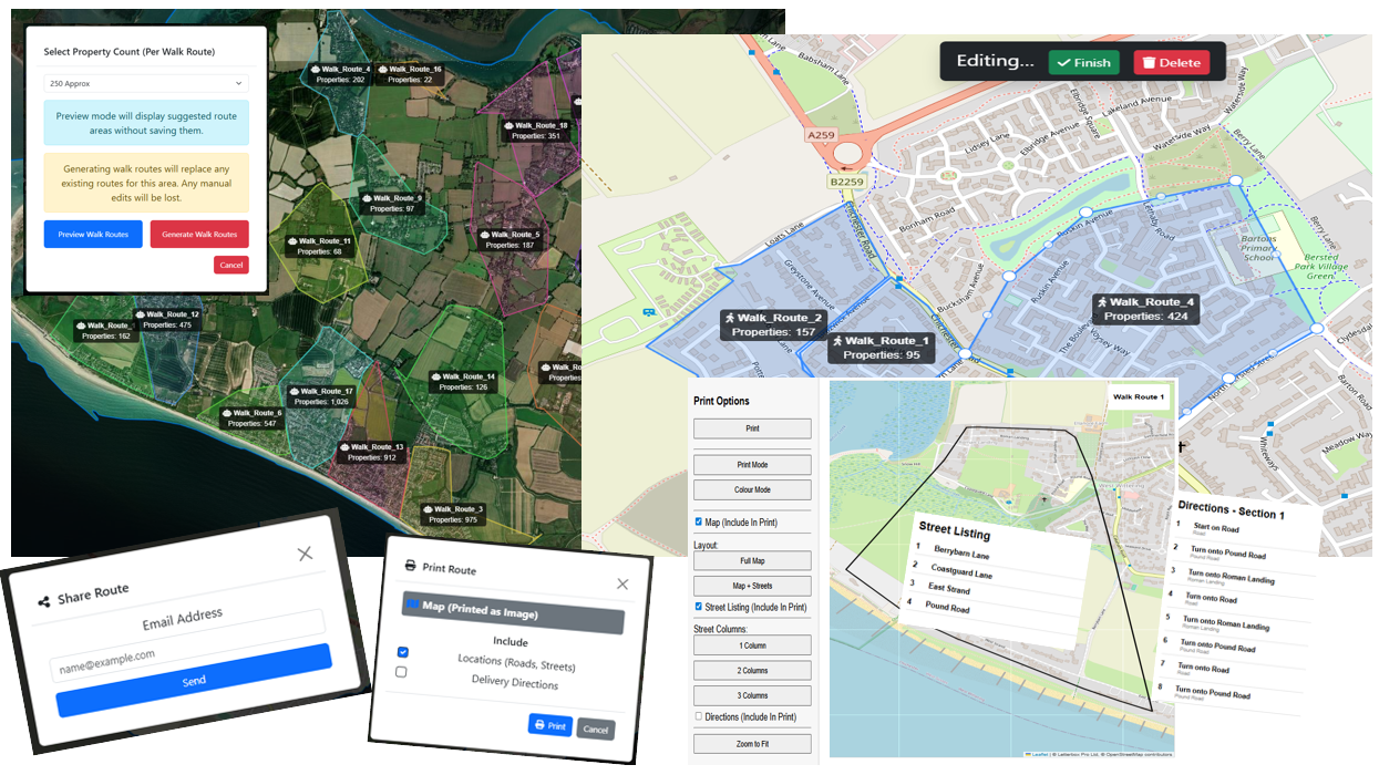
Automatic walk routes
Generate balanced walk routes based on target property counts, allowing campaigns to organise field coverage far more efficiently.
Edit and refine routes
Adjust routes manually to suit local conditions, then save updates back into the system so your field plan stays current and usable.
Print and share instantly
Export routes for print or share them directly by email, giving canvassers and organisers fast access to practical working materials.
From map to doorstep in four clear stages
CanvasserPRO gives campaign managers a structured workflow that turns planning into disciplined field activity.
Define the area
Select a constituency, ward or postcode context, then draw the precise working area your campaign needs.
Measure workload
Review live deliverable property counts so organisers know exactly what volume sits inside each route or zone.
Generate routes
Create balanced walk routes automatically, then refine them manually if local knowledge calls for adjustments.
Deploy the team
Print or share routes, keep planning aligned to boundaries and send canvassers out with clearer direction.

Professional software for campaigns that need more.
The strongest ground campaigns are built on control, visibility and repeatable processes. CanvasserPRO helps teams move from broad strategy to precise, local execution.
Bring more structure, speed and precision to your ground campaign
CanvasserPRO helps political teams plan better, route smarter and operate with more confidence on the ground. If you want a serious campaigning platform that reflects the reality of field work, this is where to start.